



ViewRanger
Trail Maps for Hiking, Biking, Skiing

ViewRanger: Trail Maps for Hiking, Biking, Skiing का विवरण
Discover inspiring trails, download offline maps, and navigate with confidence on your next hike, bike ride, backpacking trip, ski holiday, or outdoor adventure. Go outdoors, anywhere: ViewRanger works offline without mobile and data signals.
** 2018 Android Excellence award –Google Play **
** Best New Outdoor Tech –Backpacker magazine **
** Best Outdoor App –Elevation Outdoors **
** Trusted by 400 Search & Rescue teams **
>> MAPS DESIGNED FOR ADVENTURE
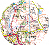
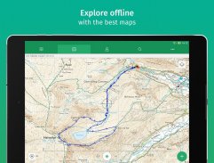
Download offline maps onto your phone before you leave home. Then explore off-the-grid, even without cell coverage. ViewRanger offers several map types, including:
** Free Worldwide Maps: Street maps, aerial and satellite images, and terrain maps.
** Premium Maps by country: See terrain and trail details other maps miss. Premium + USA maps includes four map types: USA Topo, USGS Topo, USA Land Cover, and USA Slopes. USA topographic maps zoom down to 1:24K scale with 20- to 40-foot contours in most places.
Exploring outside the US? Check out maps designed for the outdoors in 23 countries, including Canada, France, Italy, New Zealand and UK.
>> SKYLINE: AUGMENTED REALITY FOR THE OUTDOORS
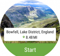
Launch our Skyline feature and pan the landscape using your Android’s camera. Skyline identifies over 9 million peaks, places, lakes in the world. Bonus: When following a route, see direction arrows and navigate to points on the real landscape. (Note: No Skyline coverage in Alaska.)
>> OS WEAR by Google
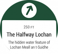
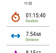
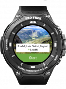
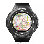
• Navigate trails and view track stats on your wrist with OS Wear enabled smartwatches.
• Record a new track and pause or stop an existing track recording.
• View heading, bearing, lat/long and altitude data.
• ViewRanger is also optimized for the Casio PRO TREK smart watch.
>> TRAIL GUIDES
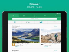
See 180,000 routes posted by top publishing brands and find trails in national parks, state parks, and national forests. Check out every mile of Appalachian and Pacific Crest Trails too.
More Online: Plan your next hiking project, draw routes, print maps, and import GPX files on our website too. Then send and follow them on your Android device. Bonus: Import GPS files from outdoor websites and handheld GPS units.
>> GPS NAVIGATION & STATS
• See your GPS location on a map.
• Record tracks and follow routes
• Plot and go to point of interests
• See live trip and navigation stats: time, speed, distance, navigation arrows, compass bearing, sunrise and sunset.
• Privately share your real-time GPS location with friends and family with BuddyBeacon™. Data connection required.
• Share routes and tracks with friends and social networks.
OTHER
Free Global maps © OpenStreetMap contributors.
Some features, such as viewing online maps, browsing routes, downloading maps and routes and sharing your location using BuddyBeacon require an internet connection.
प्रेरणादायक मार्गों की खोज करें, ऑफ़लाइन मानचित्र डाउनलोड करें, और अपने अगले वृद्धि, बाइक की सवारी, बैकपैकिंग यात्रा, स्की अवकाश, या आउटडोर साहसिक पर विश्वास के साथ नेविगेट करें। कहीं भी, कहीं भी जाएं: व्यूअरजर बिना मोबाइल और डेटा सिग्नल के ऑफ़लाइन काम करता है।
** 2018 एंड्रॉइड उत्कृष्टता पुरस्कार -Google Play **
** बेस्ट न्यू आउटडोर टेक-बैकपैकर पत्रिका **
** सर्वश्रेष्ठ आउटडोर ऐप-ऊंचाई आउटडोर **
** 400 खोज और बचाव टीमों द्वारा भरोसा **
>> साहसिक के लिए डिजाइन एमएपीएस
घर छोड़ने से पहले अपने फोन पर ऑफलाइन मानचित्र डाउनलोड करें। फिर सेल कवरेज के बिना भी ऑफ-द-ग्रिड का पता लगाएं। व्यूअरजर कई नक्शा प्रकार प्रदान करता है, जिनमें निम्न शामिल हैं:
** नि: शुल्क विश्वव्यापी मानचित्र: सड़क के नक्शे, हवाई और उपग्रह छवियों, और इलाके के नक्शे।
** देश के आधार पर प्रीमियम मानचित्र: अन्य मानचित्र मिस के इलाके और निशान विवरण देखें। प्रीमियम + यूएसए मानचित्र में चार मानचित्र प्रकार शामिल हैं: यूएसए टॉपो, यूएसजीएस टॉपो, यूएसए लैंड कवर, और यूएसए ढलान। संयुक्त राज्य अमेरिका के स्थलाकृतिक मानचित्र 1: 24 के पैमाने पर ज़ूम करते हैं, जिसमें अधिकांश स्थानों पर 20 से 40 फुट के साथ आते हैं।
अमेरिका के बाहर अन्वेषण? कनाडा, फ्रांस, इटली, न्यूजीलैंड और ब्रिटेन समेत 23 देशों में सड़क के लिए तैयार किए गए मानचित्र देखें।
>> स्काईलाइन: आउटडोर्स के लिए वास्तविक वास्तविकता
हमारे एंड्रॉइड के कैमरे का उपयोग करके हमारी स्काईलाइन सुविधा लॉन्च करें और लैंडस्केप को पैन करें। स्काईलाइन दुनिया में 9 मिलियन से अधिक चोटियों, स्थानों, झीलों की पहचान करता है। बोनस: मार्ग का पालन करते समय, दिशा तीर देखें और वास्तविक परिदृश्य पर बिंदुओं पर नेविगेट करें। (नोट: अलास्का में कोई स्काईलाइन कवरेज नहीं।)
>> ओएस Google द्वारा पहनते हैं
• ओएस पहनने सक्षम स्मार्टवॉच के साथ अपने कलाई पर ट्रेल्स नेविगेट करें और ट्रैक क आंकड़े देखें।
• एक नया ट्रैक रिकॉर्ड करें और मौजूदा ट्रैक रिकॉर्डिंग को रोकें या रोकें।
• शीर्षक, असर, लेट / लम्बा और ऊंचाई डेटा देखें।
• व्यूअरर को कैसीओ प्रो ट्रेक स्मार्ट घड़ी के लिए भी अनुकूलित किया गया है।
>> यात्रा गाइड
शीर्ष प्रकाशन ब्रांडों द्वारा पोस्ट किए गए 180,000 मार्ग देखें और राष्ट्रीय उद्यानों, राज्य पार्कों और राष्ट्रीय जंगलों में मार्ग खोजें। एपलाचियन और प्रशांत क्रेस्ट ट्रेल्स के हर मील की भी जांच करें।
अधिक ऑनलाइन: अपनी अगली लंबी पैदल यात्रा परियोजना की योजना बनाएं, मार्ग बनाएं, मानचित्र प्रिंट करें, और हमारी वेबसाइट पर भी जीपीएक्स फाइल आयात करें। फिर उन्हें अपने एंड्रॉइड डिवाइस पर भेजें और उनका पालन करें। बोनस: बाहरी वेबसाइटों और हैंडहेल्ड जीपीएस इकाइयों से जीपीएस फाइल आयात करें।
>> जीपीएस नेविगेशन और स्टेटस
• मानचित्र पर अपना जीपीएस स्थान देखें।
• रिकॉर्ड ट्रैक और मार्गों का पालन करें
• प्लॉट और हितों के बिंदु पर जाएं
• लाइव यात्रा और नेविगेशन आंकड़े देखें: समय, गति, दूरी, नेविगेशन तीर, कंपास असर, सूर्योदय और सूर्यास्त।
• अपने वास्तविक समय के जीपीएस स्थान को मित्रों और परिवार के साथ बुडीबीकॉन ™ के साथ निजी रूप से साझा करें। डेटा कनेक्शन की आवश्यकता है।
• दोस्तों और सोशल नेटवर्क के साथ मार्ग और ट्रैक साझा करें।
अन्य
मुफ्त वैश्विक मानचित्र © OpenStreetMap योगदान।
कुछ विशेषताएं, जैसे कि ऑनलाइन मानचित्र देखना, ब्राउज़िंग मार्ग, मानचित्र और मार्ग डाउनलोड करना और बुडीबीकॉन का उपयोग करके अपना स्थान साझा करना इंटरनेट कनेक्शन की आवश्यकता है।


